
Graptolite Shales Fm
Type Locality and Naming
Type section is South of Hoggar near In Azaoua. Killian (1928).
References: Killian, 1928; Valsardieu, 1971, pages 45 & 46; Berry et al., 1973.
Synonym: Graptolite Schists [Schistes à graptolites]; Graptolite Shale. Equivalent(s): Tanzuft Fm of the Djado Basin.
Lithology and Thickness
Fine sandstones and red marls with Graptolites over 10 to 25 meters change laterally to fine sandstones, micaceous, white, finely layered, with levels of interstratified schists and lenses of purple sandstones or ferruginous/oxidized breccia. Ironized/oxidized ripple-marks and fossilized mudcracks are present at the surface (Valsardieu). The most southern exposures of the graptolite-bearing shales, those in southern Libya, southern Algeria, northern Niger, and northern Chad, are commonly silty, highly micaceous, and include many siltstone and sandstone interbeds. These strata have yielded only a few poorly preserved climacograptids and diplograptids suggestive of an Early or early Middle Llandovery age and, in North Africa, are overlain by sandstones that are nearshore and possibly non-marine in origin. The highly dark organic-rich, markedly radioactive aspect of the lower layers of the graptolitic shales makes the basal part of the unit conspicuous in the subsurface throughout most of Libya, Tunisia, northern Niger, and Saharan Algeria. Limestone beds from 15 cm up to 1 m in thickness that are composed dominantly of orthoceroid nautiloids (the so-called "Orthoceras Limestone" beds or lenses or nodules) are present at sporadic stratigraphic intervals interbedded in the graptolite-bearing shales wherever Wenlock and younger Silurian age strata occur within the graptolite-bearing shale unit. Thickness is 10 to 25 m in “In Guezzam” to about 300 m in the Tin Séririne Syncline.
Relationships and Distribution
Lower contact
Underlying unit is the In-Azaoua Gr
Upper contact
Overlain by the Efeimazerta Fm or Anou Izileg Fm, depending if the former is present. Sandstones overlie the graptolite-bearing shales in all stratigraphic sequences in North Africa.
Regional extent
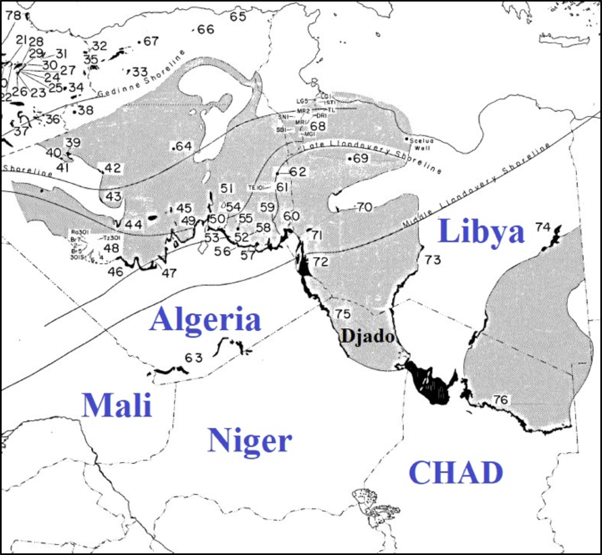
[Figure. Index map of North African Silurian outcrops (black) and subsurface (grey) (Source: Berry et al., 1973).]
GeoJSON
Fossils
The Silurian rocks exposed in the Tassilis-Ouan-Ahaggar south of Hoggar and between Aïr and "Adrar des Iforas" (#63 in Fig. 7-65) have yielded the Early Llandovery graptolites Climacograptus rectangularis, C. scalaris var. normalis, and Glyptograptus cf. G. sinuatus. Conodonts and organic microfossils (spores) are also present. Less common shelly organisms are cephalopods, molluscs, trilobites, and brachiopods.
Age
Depositional setting
Marine. The general Silurian lithofacies pattern across North Africa is one of a shoreline that prograded northwestward during the Silurian from a position in central Africa to a position in northern Africa by the Early Devonian
Additional Information